- Outdoors
- Things To Do
- Events
- Restaurants
- Lodging
- FREE VISITOR GUIDE
- Home
- Outdoors
- Hiking and Backpacking
- Graham Gulch

GRAHAM GULCH
Published with permission from the guide book: Mellow Mountain Trails Hiking Guide to Colorado’s Upper Arkansas River Valley
by Nathan Ward.
- Featuring 27 Fun Day Hikes in Buena Vista & Salida – beginner to expert..
- Maps and Elevation Profiles for each ride, including altitude gain and loss.
- Local Advice on riding areas and seasons, where to sleep, where to soak, where to find the best pizza, the best coffee and the best bars in Buena Vista & Salida, Colorado.
Graham Gulch
Interlaken is a former resort that once rivaled the Broadmoor for being the most luxurious property in Colorado. It was established in 1879 as a popular summer resort for tourists who rode the train to Twin Lakes then took a stage to the resort. Guests enjoyed horseback rides, fishing, hunting, powerboat rides and gourmet meals. Tourists also visited Interlaken in winter to ice skate, ski and enjoy sleigh rides. After the turn of the century, when the original Twin Lakes Dam was constructed, the resort became less popular and eventually closed in the 1950s when the lakes were enlarged and cut off road access.
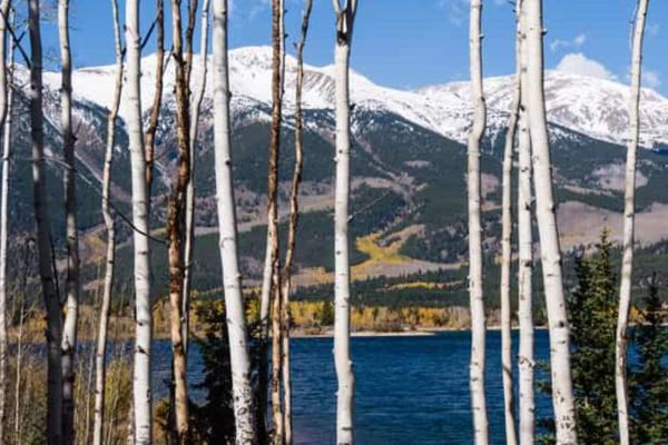
Today the trail to Interlaken is perfect for families looking for an interesting historical outing. The trail is fairly flat, skirts the lakeshore and winds through aspen forests with beautiful views of the amazing peaks around Twin Lakes. In Interlaken there are interpretive signs that tell the history of the resort and the remaining structures. The buildings are now being restored by concerned citizens and they look great. It’s the perfect place for a picnic and a splash in the cold lake.
Options
For a longer hike, simply continue walking on the trail past Interlaken. Turn around when you’ve had enough and follow the same trail back. You could circle the whole lake and this hike is just over 15 miles.
Trailhead Access & Facilities
From the stoplight in Buena Vista, continue on US 24 north toward Leadville for 18.5 miles. Turn left (west) on CO 82 toward Aspen and Twin Lakes. Drive about 0.5 mile and turn left on CR 25. Follow dirt CR 25 about 1 mile to the Colorado Trail Trailhead. Park at the trailhead. The trail starts here.
There are no facilities at the trailhead or along the trail – food and toilets available in Twin Lakes.
Location: Twin Lakes, North of BV
Distance: 4.4 Miles – Out & Back
Best Months: June through October
Trail Type: Singletrack
Difficulty: Easy
Dog Friendly: Yes
Elevation in Feet: Low Point 9,212; High Point 9,263; Climbs/Descends 63
Land Status: San Isabel National Forest, Lake County Historic District
Maps: Trails Illustrated #110
Note: Mountain bikers also use this trail.
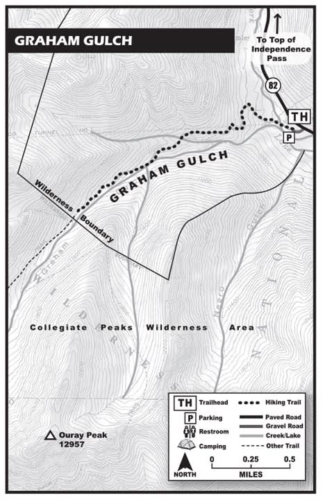
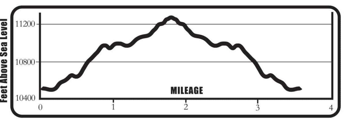
Graham Gulch Mileage Log
0.0 Trailhead – Start up the road to the right of the creek and hydro-tunnel (N39º04.92, W106º32.45). The trail splits after about 40 yards, go right and pass a “Closed to Vehicles” sign.
0.2 Stay to the right.
- Stay to the right.
- Cross a small creek.
- Switchback right.
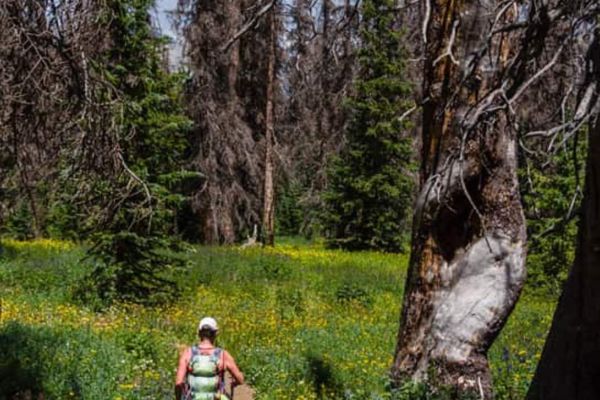
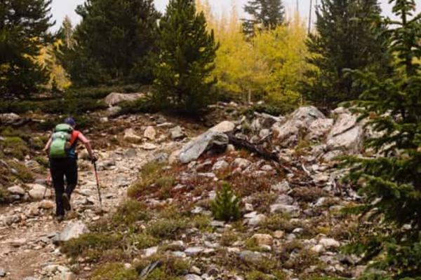
1.3 The trail crosses a large open area full of bushes and flowers (N39º04.87, W106º33.54). This area is occasionally swept by large avalanches from the peak above to your right. Don’t worry – this only happens in winter.
- The trail crosses the creek and goes uphill left (N39º04.89, W106º33.69).
1.6 About 40 yards uphill from the creek, stay on the most obvious road as it switchbacks up to the right (N39º04.84, W106º33.68).
The Graham Gulch road/trail actually continues straight ahead and is a good option for people who want to explore more on the way back down. If you go farther and enter the wilderness area, your dog needs to be on a leash to keep it legal.
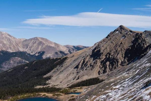
1.8 Enter a high basin surrounded by peaks. This is the end of this hike and a good place to soak up the sun and views (N39º04.43, W106º33.77). Enjoy!
Follow the same trail back down.
3.6 Back at the Trailhead
BE PREPARED
We want you to have a safe and enjoyable trip into Colorado’s backcountry. Be prepared it could be a long walk out. Be sure to read this list of equipment you should bring on your ride along with tips to make your biking trip more enjoyable.
TRAIL ETIQUETTE
The Colorado backcountry is popular – bikers, hikers, motorcycle riders, hunters and equestrians use the trail system in the Arkansas Valley, and everyone wants a private piece of heaven. Even if you don’t agree with everyone’s motives or methods of travel, please treat them in a courteous manner.
CORSAR CARD
If you require search and rescue services, it can be costly. Buy a Colorado Outdoor Recreation Search and Rescue (CORSAR) card to protect yourself. Funds from the CORSAR program go into the Colorado Search and Rescue (SAR) Fund. If a CORSAR card holder becomes lost or injured in the backcountry, the Colorado SAR Fund pays eligible search and rescue expenses.
CARE FOR COLORADO – ARE YOU COLO-READY?
Visitor Photos
Buena Vista Chamber of Commerce
111 E Main St
Buena Vista, CO 81211
Salida Chamber of Commerce
406 W Rainbow Blvd.
Salida, CO 81201
© 2025 Chaffee County Visitors Bureau | All Rights Reserved
Site developed by ![]() Agency Tourism Marketing
Agency Tourism Marketing

